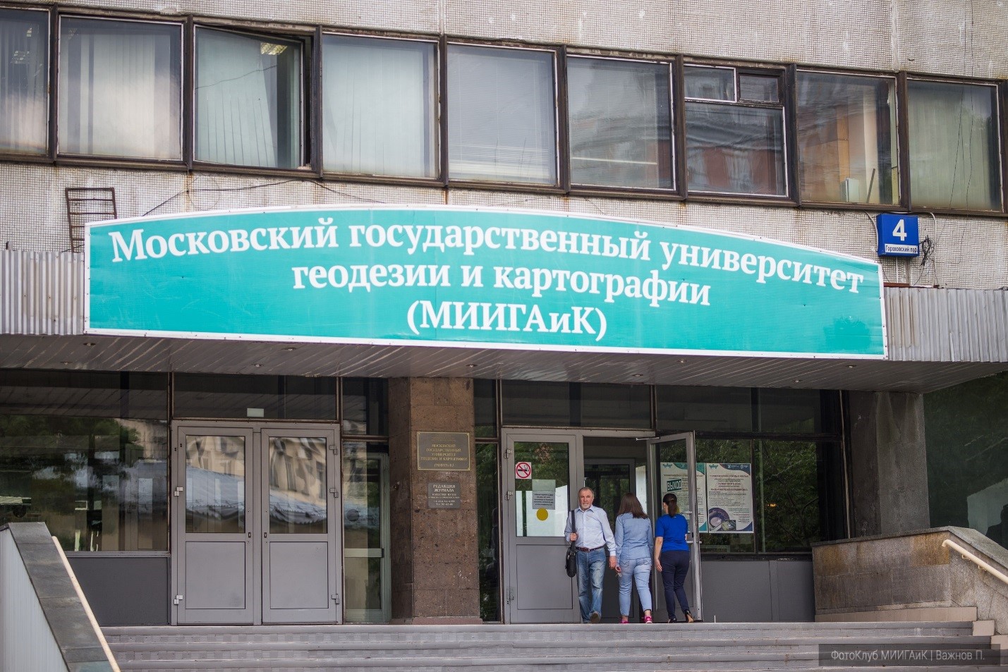
Moscow State University of Geodesy and Cartography
Moscow University of Geodesy and Cartography (MIIGAiK) is a recognized scientific and educational cartographic-geodesic center of Russia.
The Federal State Budgetary Institution of Higher Education "Moscow State University of Geodesy and Cartography" (MIIGAK) is an educational institution of federal subordination, which has the status of a legal entity, and implements educational programs of higher, postgraduate and additional education. The University has the right to conduct educational activities in the main and additional educational programs: secondary vocational education - 59 programs, higher education - 68 programs; postgraduate education - 15 programs; additional education - 6; training programs - 36.
The main strategic goal of MIIGAiK is to determine the staffing of the cartographic and geodesic industry in Russia based on world-class research and development, which is to train specialists of primarily higher qualifications to generate new knowledge, preserve and distribute it, create and transfer new technologies and products based on the needs of forming and meeting the demand of the domestic and foreign markets that are relevant in relation to the scientific and educational fields University property.
The achievement of the strategic goal is carried out by MIIGAiK on the basis of the creation of a research, innovative corporate culture, through the active direct participation of students, graduate students, teachers, and researchers in the joint implementation of research projects, development and commercialization of products. The main competitive advantage of the university in the implementation of the mission is the presence of historically established unique vocational schools (geodesic, cartographic, remote sensing of the Earth), which, both in educational and scientific activities, focus on the priority areas of science, technology and technology development. geodetic, cadastral and information and communication technologies, optical technologies, laser technologies, environmental monitoring, Instrumentation and others. Research performed at the University play a fundamental role and determining the content and technology of the educational process. On this is based the fact that in the field of earth sciences, a university is rightfully considered one of the leading scientific and educational centers in Europe and the world. The fact of international recognition of the university and the contribution of its graduates to the development of geodesy, cartography and remote sensing technologies is the authority and membership of MIIGAiK in numerous foreign scientific and educational organizations.
Strategic objectives:
creation and strengthening of productive relations and commercial partnerships with advanced production organizations, leading academic and scientific and educational institutions, educational and scientific and technical centers, providing access to the market for scientific research;
ensuring the priority of innovation in the field of education, scientific and technical activities in the production of scientific and technical products and services;
creation and development of new educational technologies through the support of scientific and pedagogical schools, scientific and technical centers and the productive ideas of teachers, staff and students;
implementation of the results of fundamental and applied research and innovation in the field of earth sciences in the educational process with the aim of improving the quality and ensuring the competitiveness of graduates in the modern labor market, both in Russia and abroad;
formation of students, faculty and staff in the worldview along with the priority of academic values in the education of a harmonious and moral personality, the desire to translate entrepreneurial ideas, as well as the spirit of leadership and corporate culture, the ability to live and win in a competitive environment;
ensuring the integration (taking into account national peculiarities) of education, science and culture of Russia into the world educational environment and culture.
formation of long-term staff and research reserves necessary to strengthen and enhance the competitiveness of the industry;
consolidation of sectoral educational programs and scientific research in the international market.Scientific schools
Currently, more than a dozen of cartographic-geodetic research schools recognized in Russia and abroad successfully operate within the walls of MIIGAiK. Two scientific schools of MIIGAiK, which are winners of the competitions 2006, 2008, 2010, 2012, 2013, 2014 and 2015 conducted by the Federal Agency for Science and Innovations of the Russian Federation and the Council for grants of the President of the Russian Federation, recognized by the leading scientific schools of Russia, namely, the school under the leadership of the member-correspondent RAS, prof. Savinykh V.P. “Development of the theory and methodology of dynamic mapping of earth covers based on materials of space imagery”, and the school under the direction of Dr. Sc., Prof. Department of Geodesy Yambaeva H.K. "Development of the theory and methodology of geodetic monitoring of movements and deformations of the earth's crust."Research activities carried out by MIIGAiK include research and development in the following priority areas for the development of science, technology and engineering and critical technologies of the Russian Federation, approved by Presidential Decree of 07.07.2011 No. 899:а) Priority areas:
information and telecommunication systems;
rational nature management;
transport and space systems;
b) critical technologies:
- technologies for access to broadband multimedia services;
- information technology, control, navigation systems;
- technologies and software of distributed and high-performance computing systems;
- technologies for monitoring and predicting the state of the environment, preventing and eliminating its pollution;
- technologies for the prevention and elimination of natural and man-made emergencies;
- technologies for creating high-speed vehicles and intelligent control systems for new types of transport;
- technology to create a new generation of rocket and space vehicles.
In accordance with the university’s development program for the period, the central task of MIIGAiK’s innovative development is the creation in the next 2 years of an innovative consolidated research and education system (research and education cluster) in the field of geodesy, cartography and cadastres, the basic component of which would be Moscow State University of Geodesy and Cartography (MIIGAiK). According to many experts, this is the most optimal way to solve the problem of a substantial improvement in the quality of education. Such cooperation provides a real opportunity to combine training based on the fundamental knowledge gained at the university, and practical training of graduates in successful scientific and industrial organizations. The university cluster being created will ensure satisfaction of the current and future personnel needs of the Russian economy in the field of geodesy, cartography and cadastre.Scientific laboratories and centers on the basis of MIIGAIK
1. Integrated laboratory for extraterrestrial research
As part of scientific research in the field of space geodesy and photogrammetry of the celestial bodies of the Solar System, photogrammetric processing of images is carried out, digital models of surface relief are created, orthophotoplans or ortho mosaics are created, the gravitational fields of small bodies are studied, the shape and other parameters of celestial bodies are determined .
The research results are used to create cartographic products in geographic information systems, simulate and prepare space missions, simulate the gravitational field, analyze the morphology and geology of the bodies of the solar system.
Using satellite images and telemetry data, optical distortion correction is performed and images are linked together. On the basis of special processing of images, a three-dimensional measurable surface model (digital elevation model) is created, on which corrected and mutually attached images are superimposed. The result is a photographically accurate, measurable terrain model (orthophoto mosaic).2. Antenna receiving complex of remote sensing data
Using:
- for conducting scientific and educational activities;
- for the preparation of dissertations and WRC students, undergraduates and graduate students;
- for refresher courses;
- summer work practices.3. Innovative research and production cartographic center MIIGAK (INPCC)
The team of the Research and Production Cartographic Center actively participates in the grant activity of MIIGAiK through the implementation of scientific, technical and scientific projects of the Russian Federal Property Fund and the Russian Geographical Society. In total, from 2011 to the present, the team has successfully completed 17 grant projects, including: the edition of the Atlas of Russia of the Cartographic Encyclopedia series; "Comprehensive geo-information mapping and assessment of the impact of pollution sources on the state of the environment of Russia"; “GIS mapping and monitoring of the ecological situation of the Arctic islands based on remote sensing materials”; "Comprehensive survey and mapping of a group of islands of the Small Kuril Ridge based on high-resolution spatial data"; Geoportal "Geo-Russia" and others. The main results of the team are presented on our Internet resource: www.rusgeoportal.ru
In 2014, the Russian Cartographic Encyclopedia project became a finalist for the Russian Geographical Society Award in the Geographical Research nomination.
Our work uses software products: ArcView (ArcInfo), Panorama, Agisoft, Mapinfo, Adobe Illustrator, Adobe Freehand, and others.The asset also has databases and digital cartographic materials in graphic and GIS formats for the territory of Russia in scales from 1: 200,000 to 1: 1,500,000 and smaller, in the territory of countries of the world in the mass 1: 200,000 to 1:17 million;
The team made a number of fundamental cartographic and geographic information projects, such as:
Map "World of the XXI Century" (2nd place at the IMTA Barcelona conference, 2001);
Moscow Atlas of the series “Illustrated Cartographic Encyclopedia” (the atlas received the 1st place at the XXIII Conference of the International Cartographic Association (ICA) in 2007);
Atlas of Russia series Сartographic encyclopedia", (2012);
Atlas of railways of OSJD countries, (2013);
Monitoring of Arctic Шsland ecosystems based on remote sensing materials (2015);GBGN - global geographic names database, 2017, and at least 15 more projects.
The scientifically significant results of the work and the implementation of collective projects are the basis for the following topics and programs, as reflected in scientific articles and scientific and technical reports:
1. Innovative technologies for the use of materials for remote sensing of the Earth.
2. Building a spatial model of air pollution based on the use of data streams from networks of geosensors.
3. Method of creating synthesized geo-images.
4. Navigation maps. Methods and technology of their development and creation.
5. Analysis of problem areas: natural objects and processes that can affect the components of the environment, as well as reverse processes - industrial objects and the ecological state of the territories.
6. Development of technology for rapid automated mapping of sources of pollution and their zones of influence on the state of the environment.
7. Development of technology for interactive environmental monitoring using satellite communications and the Internet.
8. Analysis of anthropogenic disturbance of territories based on modern methods of using CFS and aerial photography of high and ultra-high spatial resolution.4. Center of sectoral monitoring systems and information security
The center operates in the following areas:
Development of sectoral monitoring systems
Information Security
Connection to external information systems
Maintenance of individual information systems
Used and developed technologies:
Server stack (Python): SQLAlchemy (ORM) - data layer, XAUWS, FLASK - microform for building web applications
Client stack (HTML \ CSS \ JavaScript): Vue.js, Highcharts, Highmaps, ChartJS, DevExpress Devextreme, Leefleat, Bootstrap
GIS: QGIS Desktop - preparing spatial data for the web,
Map services (OSM, Yandex, Google, etc.),
OSMRoute (http://project-osrm.org/), PostGis
DBMS: PosgreSQL, Mysql, MS SQL
NOSQL: Elastix Search - high-performance full-text search. Redis is a non-relational high-performance DBMS.
Analytics: Dashboard (web info panels), RTF, Excel.
Operating Systems: Ubuntu LTS, Astra Linux, Centos, Windows Server
Other: Ansible, WebPack, Sass, Git, NGINX, Apache HTTPD, HAProxy5. Common Intersectoral Center
Carries out its activities by attracting various specialized specialists, teachers, students, young scientists to applied and scientific work in the following areas:
Municipal economy
Forestry
Transport and communications
Fuel and energy complex
Emergencies
Natural resources
Agriculture
Construction
Geology and mining
Ecology
6. Center for Youth Innovative Creativity “DIGITAL EARTH”
The Center for Youth Innovative Creativity "DIGITAL EARTH" is created on the basis of the Moscow State University of Geodesy and Cartography and will allow schoolchildren, students, young entrepreneurs and city residents: to master modern ways of collecting, processing, analyzing and visualizing spatial information.
participate in the development and testing of prototypes of new devices and technologies for collecting spatial data, such as:
quadrocopters and unmanned aerial vehicles, their components, including devices for photo and video shooting,
combined devices for environmental research, including using GLONASS / GPS modules,
mobile applications for navigation and data collection, etc.
to get acquainted with the full cycle of receiving and processing satellite images and to carry out scientific and educational projects with their help
immerse yourself in the world of 3D - from the stages of designing or shooting an object, before printing it on a 3D printer or creating a layout using specials. machine tools.
The project of equipping and functioning of the Center for Youth Innovative Creativity “Digital Earth” is carried out within the framework of the implementation of the subprogram “Moscow is a city for business and innovations” of the State program of the city of Moscow “Economic development and investment attractiveness of the city of Moscow” for 2012-2018 and is carried out in the format of Youth Centers innovative creativity - open centers, where schoolchildren, university students, young entrepreneurs and residents of the city have access to modern equipment direct Frova production, engaged in the design, prototyping, manufacturing, and can be developed in science and technology, innovation and industrial areas.
School children, students, young entrepreneurs and city residents in the Digital Earth Center master modern methods of collecting and visualizing spatial information and participate in the development and testing of prototypes of spatial data collection devices and technologies, such as: Multikopter, unmanned aerial vehicles and their components;
Combined devices for environmental research;
Mobile applications for navigation and data collection.
The activity of "Digital Earth" is based on the tasks of collecting, processing and visualizing data with spatial reference. The whole world around us and each of its individual objects have spatial coordinates that allow them to be accurately determined in space. Each of these objects has its own set of properties that can change over time. In order to track these changes in time and predict further events and phenomena, it is necessary to perform regular monitoring of the area or individual projects. At the same time, all received and previously accumulated information should be conveniently stored and geographically and geometrically displayed correctly to obtain accurate results of its processing and analysis. The most convenent way is to use geographic information systems.